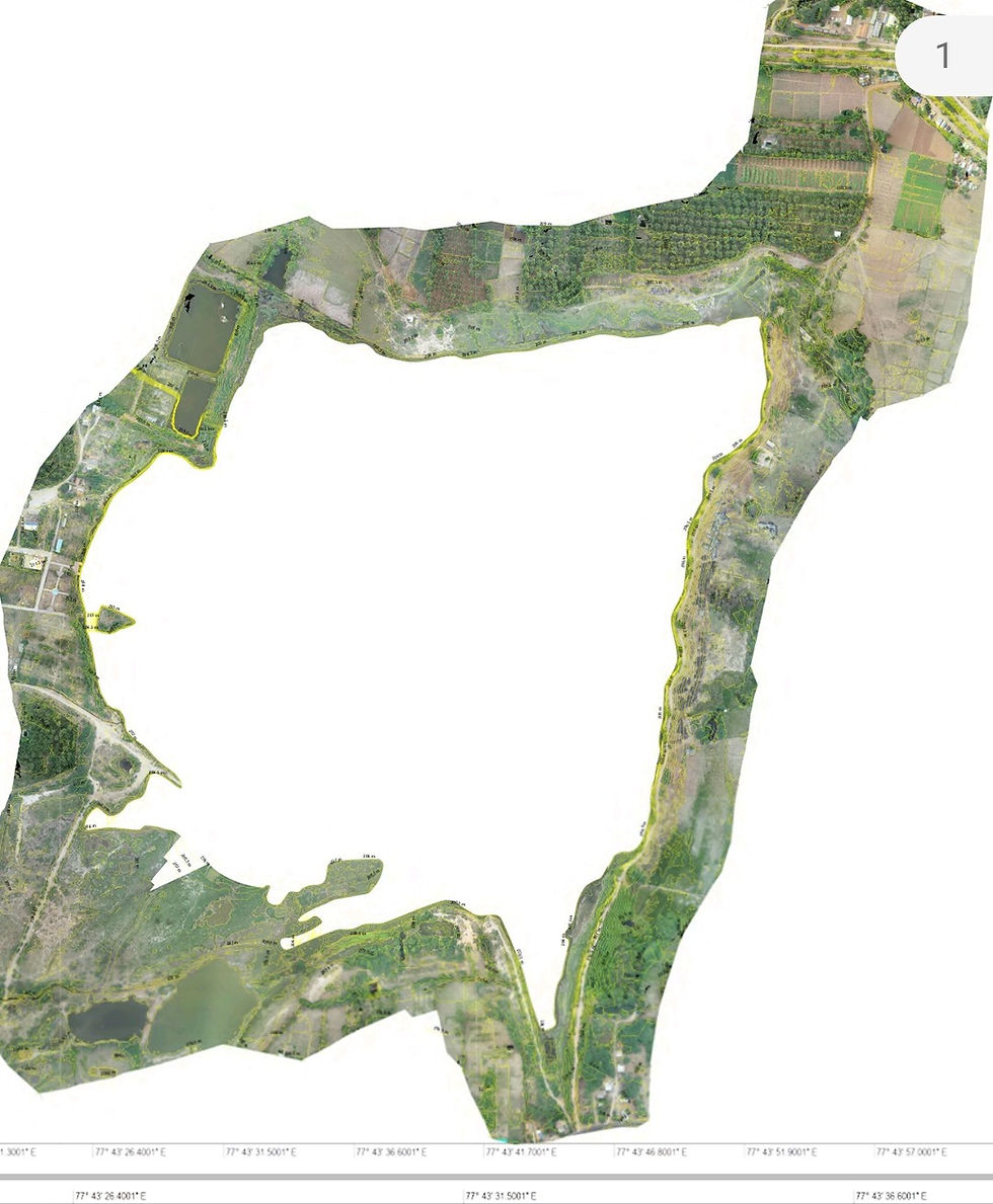
What kinds of maps can you expect from drone Survey?
- Dokimi GeoEngineering

- Mar 16, 2022
- 2 min read
Orthomosaic maps

Drone images are used to recreate highly-accurate orthomosaic maps of mining sites and quarries. Each pixel contains 2D geo-tagged information (X, Y) and can be used for distance and surface measurements
File formats: geoTIFF (.tiff), .jpg, .png, Google KML
3D point cloude

A densified point cloud can be generated from drone images and data. Each point contains geospatial (X, Y, Z) and color information. It provides a very accurate model of a site for precise volume measurements and visual insights that enhance future planning.
File formats: .las, .laz, .ply, .xyz
Digital Surface model (DSM) & Digital Elevation Model ( DEM)

After filtering objects such as buildings, machines and conveyor belts, drone images can be used to create digital terrain or Elevation models, with each pixel containing 2.5D information (X, Y, and Z values of the highest altitude). These models allow you to identify stockpiles and pit changes, and to model water flows and wall collapses.
File formats: GeoTiff (.tif)
Land Use & Land Cover

Land cover data documents how much of a region is covered by forests, wetlands, impervious surfaces, agriculture, and other land and water types. Water types include wetlands or open water. Land use shows how people use the landscape – whether for development, conservation, or mixed uses.
File formats: Drawing or Shape or raster map
Contour Map

Contours are lines that connect locations of equal value in a raster dataset that represents continuous phenomena such as elevation, temperature, precipitation, pollution, or atmospheric pressure. The line features connect cells of a constant value in the input
File formats: Drawing or Shape
3D textured mesh

3D textured mesh is a reproduction of the edges, faces, walls, vertices and textures of the area captured by the drone. This visual depiction of a quarry or mining site is most useful for inspecting unreachable areas, such as pits and slopes.
File formats: .ply, .fbx, .dxf, .obj, .pdf


Comments